Wradlib

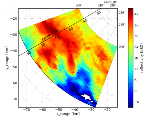
Wradlib is designed to assist users in the most important steps of processing weather radar data. These include: reading different data formats, georeferencing data, identifying and correcting typical error sources (such as clutter or attenuation), converting reflectivity to rainfall intensity and visualizing the data.
Core features
-
data formats
- NetCDF - CfRadial (r/w)
- HDF5 - ODIM_H5 (r/w)
- Sigmet IRIS (r)
- Selex ES Rainbow (r)
- raster and vector data using GDAL (r/w)
-
data visualisation
- plan position indicator (PPI)
- range height indicator (RHI)
- maximum intensity plot (MAX)
- constant altitude plan position indicator (CAPPI)
- scan strategy
-
data correction
- ground clutter
- attenuation
- beam blockage
-
georeferencing
- bin height/distance
- spherical to cartesian coordinates
- reproject spatial reference systems
-
rainfall estimation
- Z-R-relation
- hydrometeor classification
-
special features
- volume matching satellite radars
- zonal statistics
- radar compositing

