SFCGAL

SFCGAL is a C++ wrapper library around CGAL (Computational Geometry Algorithms Library) that provides robust and advanced 2D and 3D geometric computations.

SFCGAL

SFCGAL

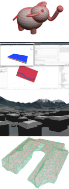
SFCGAL supports OGC Simple Features such as points, lines, and polygons, as well as more complex 3D geometries including PolyhedralSurface, TIN (Triangulated Irregular Network), and Solid.

It implements ISO 19107:2019 and OGC Simple Features Access 1.2 standards, offering precise rational number representation for coordinates in both 2D and 3D space.

Its C and C++ APIs enable integration with spatial databases and GIS software like PostGIS and GDAL for advanced 2D and 3D computations.

  • Enables complex spatial operations and analyses in PostGIS. Learn more about SFCGAL in PostGIS
  • Supports advanced geometric processing in GDAL, including triangulated irregular networks (TIN) and polyhedral surfaces. See GDAL RFC 64
  • Offers multiple bindings, including an official Python binding
  • Utilized in a QGIS plugin: QSFCGAL
  • Integration into QGIS core is under consideration for robust 3D calculations management

Core features

  • Geometry Types

    • Support for 2D, 3D and 4D geometries
    • Includes (Multi)Point, (Multi)LineString, (Multi)Polygon, (Multi)Triangle, Triangulated Surface, Polyhedral Surface, (Multi)Solid
  • Spatial Operations

    • 2D and 3D Boolean operations
    • Validation of 2D and 3D geometries
    • Buffer creation for 2D and 3D geometries
  • Measurement Functions

    • Area and volume calculations
    • Length and distance computations
  • Advanced 3D Operations

    • Extrusion of 2D geometries to 3D
    • Straight skeleton computation (Axis, Extrusion, Partition)
  • Triangulation

    • Constrained Delaunay triangulation
    • Robust Polygon triangulation
  • 2D and 3D Approximation and Simplification

    • Minkowski sum
    • Alpha shapes
  • Integration

    • C and C++ API with bindings for other languages
    • Official Python Binding
    • Used as a backend for PostGIS and GDAL

Implemented Standards

  • International Organization for Standardization (ISO)
  • (ISO 19107)
  • Open Geospatial Consortium (OGC)
  • Simple Features Access (SFA)
  • Simple Features for SQL (SFSQL)
  • Well-Known Binary (WKB)
  • Well-Known Text (WKT)
sfcgal_osgeo_banniere-140x380_v2

Service Providers

Core contributors

View all service providers