GIFramework Maps

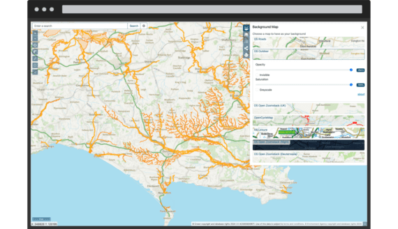
GIFramework Maps is a .NET based web mapping application designed and developed by the Dorset Council GIS team.

GIFramework Maps

GIFrameworkMaps

GIFramework Maps is used by Dorset Council as their primary web mapping application for staff and the public. You can see it running live here.

GIFramework Maps is Open Source software (using OpenLayers and Bootstrap, as well as many other libraries) and is licensed under the MIT licence.

Core features

  • Web mapping application

    • Create 'versions'
    • Enable OpenID Connect authentication
    • Connect with OGC web services
    • Allow users to add layers

Implemented Standards

  • Catalogue Service for the Web (CSW)
  • Geographic JSON (GeoJSON)
  • Keyhole Markup Language (KML)
  • Open Geospatial Consortium (OGC)
  • Web Feature Service (WFS)
  • Web Map Service (WMS)
  • Web Map Tile Service (WMTS)
GIFramework

Service Providers

Core contributors

View all service providers