eodash

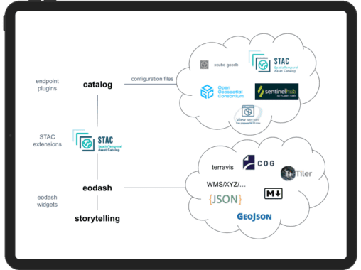
The eodash ecosystem provides a user-friendly, configurable, and extendable toolset for presenting results and achievements in the Earth Observation domain. It is designed to be accessible online.
This ecosystem is built through collaboration with various Earth Observation communities to ensure that it meets the necessary requirements. The eodash ecosystem is structured as an open community project, fostering communication and collaboration.
Its core functionality establishes a baseline that allows each community to easily integrate their unique solutions.
The documentation is designed to support:
- Service administrators who are exploring how to set up or integrate the eodash ecosystem into their environments, thereby extending services to other users.
- Community members and users of extended service suites where the eodash ecosystem has been integrated, providing information on how to incorporate their data and results.
This project was developed by EOX, with funding and support from the European Space Agency (ESA) in the frame of the Euro Data Cube, RACE, EO Dashboard, and GTIF activities. We are grateful for the financial contributions and ongoing support provided by ESA, NASA, JAXA, and the European Commission, which enabled the development and maturation of this project to its current state.


