
ETF

ETF is a testing framework for validating data and APIs in Spatial Data Infrastructures (SDIs). It is used by software solutions and data providers to validate the conformity of geospatial data sets, metadata and APIs.

community project

ETF

community projectETF_logo

Goals in designing the ETF software were to create test reports that are user-friendly and self-explanatory as well as to be able to validate large amounts of data, which can be several hundred GB in size. In order to cover different validation tasks and present them in a unified report, the architecture is modular and different test engines can be used. Currently the following test engines are supported: SoapUI for testing web services, BaseX database for testing XML data, TEAM Engine to validate WFS and OGC Web APIs using the OGC CITE tests, NeoTL Engine for testing WFS, OGC Web APIs and datasets.

ETF is the underlying framework used by the INSPIRE Reference Validator to validate metadata, datasets and services against the INSPIRE requirements. ETF is also used extensively in Germany by the Surveying Authorities of the Laender to validate their datasets. Other European Union (EU) Member States are also reusing the ETF to allow their data providers to test resources against national requirements. Finally, some software tools include validation based on the ETF API in their workflow.

Core features

  • Testable resources

    • datasets (up to multiple hundreds GB): GML
    • metadata: XML
    • view services: WMS/WMTS
    • download services: Atom, WFS, WCS, SOS
    • catalogue services: CSW
    • large data sets (multiple hundreds of GB)
  • Supported test engines

    • SoapUI for testing web services
    • BaseX for testing sets of XML documents
    • TEAM Engine to support CITE tests developed using TestNG
    • NeoTL for testing OGC WFS and OGC APIs (in development)
  • Access

    • web-based user interface
    • REST API
    • OpenAPI Specification
    • Java client library
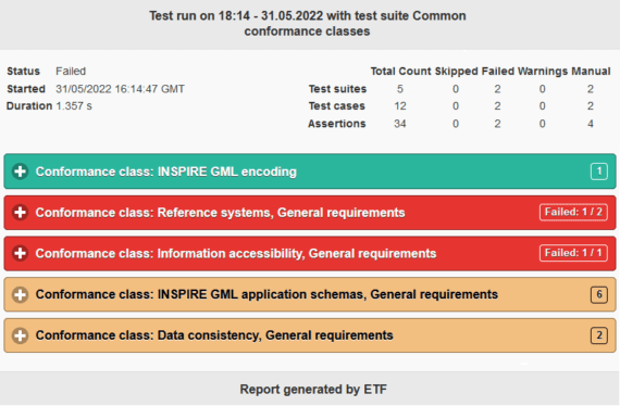
  • Test reports

    • user-friendly and self-explanatory
    • downloadable in HTML, XML and JSON

Implemented Standards

  • Catalogue Service for the Web (CSW)
  • Geography Markup Language (GML)
  • International Organization for Standardization (ISO)
  • (ISO19105)
  • (OGC API - Features)
  • Sensor Observation Service (SOS)
  • Web Coverage Service (WCS)
  • Web Feature Service (WFS)
  • Web Map Service (WMS)
  • Web Map Tile Service (WMTS)
screenshot_report4