OSGeo would like to help you share your FOSS4G project with the world:
- Create an OSGeo UserID.
- If this takes more than 24 hours to get the mantra, ask for help via sysadmin@osgeo.org or ask for help in matrix.to/#/#sac:osgeo.org or web.libera.chat/#osgeo-sac chat room.
- Sign in to the OSGeo WordPress website at https://www.osgeo.org/wp-admin with your OSGeo User ID.
- Signing in creates a profile on the website which is required to add content.
- Join the incubator committee incubator@lists.osgeo.org email list, and request permission on the website to create a project page.
- Mention your OSGeo User ID, so we can grant you the “project author” permissions in WordPress
- The incubation committee use a checklist to review your project.
- Be geospatial
Confirm by checking README or project description - Have a free license or open source license
The license must be OSI approved - Welcome participation and new contributors.
We look for a clear contribution policy
- Be geospatial
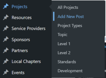
- Use + New > Project to create a new project page
- Forms are used to collect information about your project
- Detailed instructions are provided below
- Users will be automatically logged out after some inactivity. Make sure you save your progress using Save Draft if needed.
- When ready ask the incubation committee to review your page and publish.
- Thank you for contributing to our FOSS4G community.
Listing your project on the OSGeo Website
Good examples to review before starting:
- GeoNode was created by the graphic designer responsible for the website and is the reference example. It shows how to use a team photo, use framed screenshot, and topics effectively.
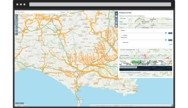
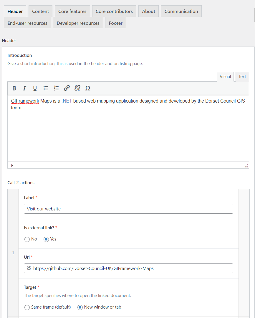
- GIFramework Maps was used as an example when working on these instructions
It will take about ten to fifteen minuets to fill out the page. The form fields are split across different tabs as described below.
Logo and screenshot guidelines
Required: Before you start we need you to prepare your logo for use in our service provider list.
- Position your logo on a 740 x 412 tile for use on the website.
- Save tile_template.png to use as backdrop.

- Position your logo in the centre of the tile.

- Have this file on hand when creating adding your project below.
Optional: If you wish to include a screenshot please frame in a template to respect website visual appearance.
- Example frames are available in the template folder of OSGeo GitHub:
If you have a creative idea for another frame please share!
- Position your screen shot in the appropriate frame above.
- Have the combined screenshot file on hand when adding the Content section of your project below.
Create a Project
If you have used WordPress before you may be expecting to create a “page” or a “post”. This website uses a “Project” form that contain many panels of information to fill in resulting in an attractive consistent presentation.
To create a Project:
- Use the New short cut at the top of the screen and select Project from the list of content types

- From the WordPress Dashboard find the Project content on the right hand side, and select Add New Post.
Project
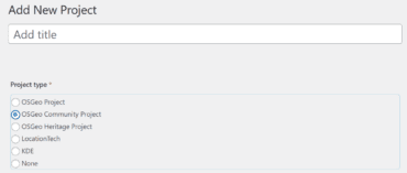
The Project form starts out with key information used for the project listing:
- Title: Name of your project.
- Project Type: If you are setting up your page initially, choose None
Projects that have joined the “OSGeo Community Initiative” or graduated as full “OSGeo Project” or associated with a parter organiszation will choose those options.
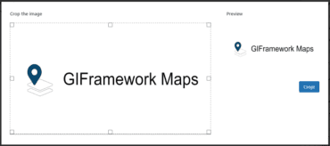
- Logo: Select your prepared logo from the list of available media, uploading if necessary.
When adding your logo you are instructed to crop it to the required aspect ratio, if you used the 720×412 template above you will not lose any content.
- Officer or representative: Select contact person for this project.
This will usually be you, and you are selecting your OSGeo User ID here. - Website: Add the project website.
- Source: Add the website for the project source code.
- Documentation: Add a link for the documentation.
This information, along with the header introduction below, is used to define a “Tile” in the project list.

Header
First tab defining header area:
- Introduction, show at top of page along side logo.
- Call-2-actions, shown as action buttons under logo linking to website page or external link.
- Photo, often used for a team photo to fit in with people-first OSGeo website message the open source is made by and for people.
The call to action buttons are very visible and can be used to link your website, GitHub repository, or open source community statement.
Project Details
Along the right hand side of the form are details used for discovery (look under Publish):
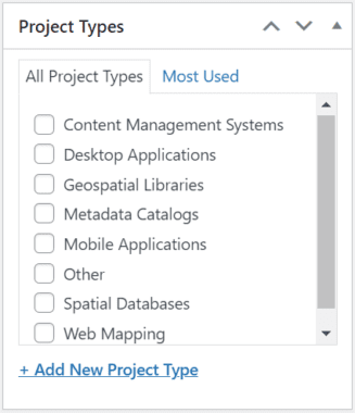
- Project Types: Select what categories your project falls under.
This is used to organize the “Projects” menu at the top of the OSGeo website, and is also available as a “Filter” when viewing the projects list.
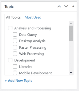
- Topic:
This is used to locate your project in the “Choose a Project” wizard introducing FOSS4G technology to newcomers.
You are encouraged to select all appropriate topics (for example GDAL would be listed under Analysis and Processing > Raster Processing and Development > Libraries).
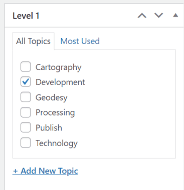
- Level 1: Pick an area
This was used by the original 2006 website, and not currently used for projects.
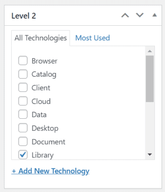
- Level 2: Pick an area
This was used by the original 2006 website, and not currently used for projects.
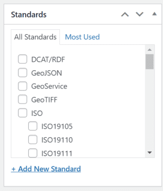
- Standards: Please indicate which standards your project uses
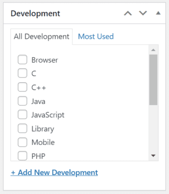
- Development: Please choose which language your project is written in
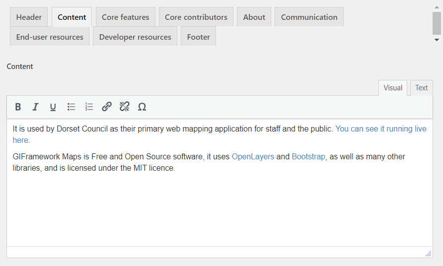
Content
Second tab for page content:
- Content, introduce your project!
- Image, product image if appropriate, prepared above.
The image intended be framed in a laptop, mobile, tablet, or browser. See templates here:
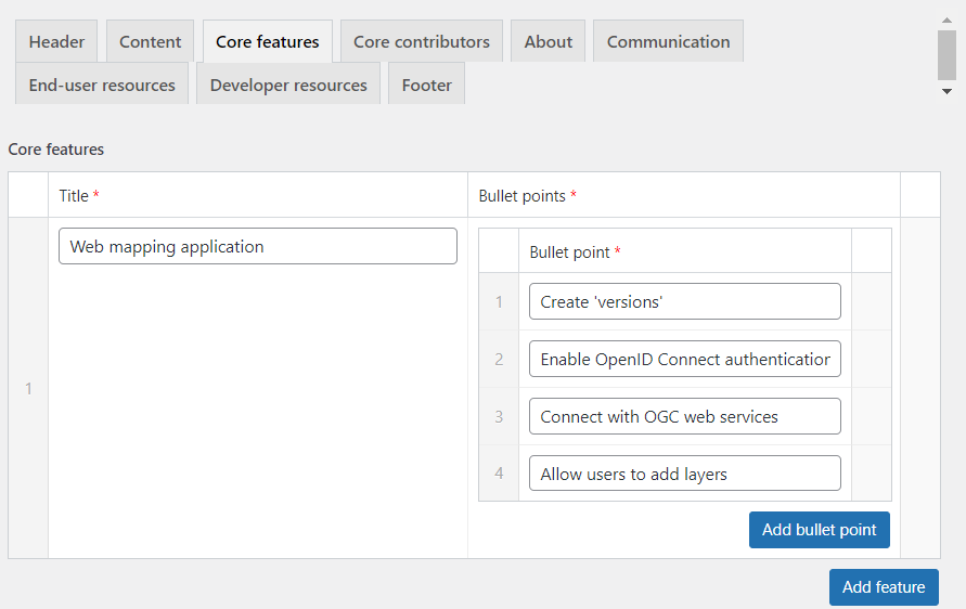
Core Features
A list of core features of the application
- Click Add feature to add a row, and click Add bullet point to add each bullet point.
Core Contributors
A list of core contributors to the project. You will need to add your organization as a Service Provider to appear in this list.
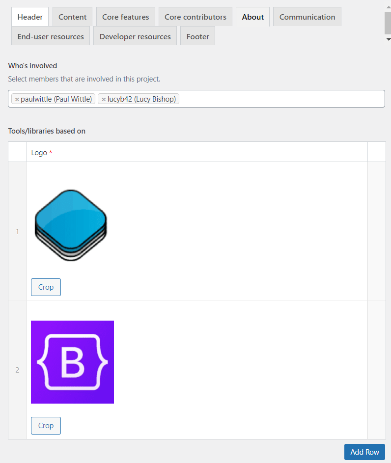
About
Increasing page visibility with cross links to OSGeo content including:
- Who’s involved, add in by OSGeo User ID.
- Tools/libraries based on
- Similar Projects (already listed on OSGeo)
- Similar Proprietary Products (free text)
This is used to provide a migration option for those seeking to migrate to FOSS4G technologies. PostGIS for example lists Oracle as a similar proprietary project. Please respect any trademarks mentioned with an appropriate disclaimer in the “Footer” section below. - License
- Specs
Communication
- Add your social media handles
End-user resources
- Add links to Demos, Documentation, etc.
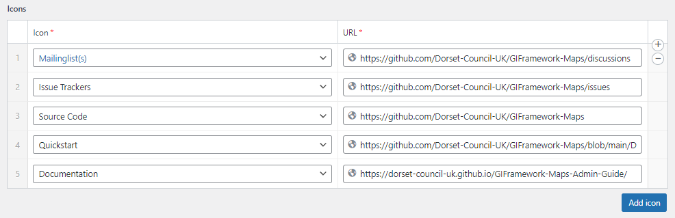
Developer resources
- Add links to Source Code, Issue Tracker, etc.
Footer
- Add extra text at the bottom if you wish.
This is used for any required fine print, such as to acknowledge trademarks mentioned in “Similar Proprietary Products”.
Optional: Join OSGeo Community Projects Initiative
The Open Source Geospatial Foundation has an “OSGeo Community Project” Initiative to help foster new and innovative technology:
- Interested project teams may contact the incubation committee asking to join the “OSGeo Community Initiative”.
- The incubation committee uses a checklist to review your application to join.
- Be geospatial
Confirm by checking README or project description
Project page on the osgeo website
We ask projects have some user documentation, for example an OSGeo Live quickstart - Have a free license or an open source license
The license must be OSI approved
We ask that the project team double check the license has been appropriately applied (for example checking the file headers) - Welcome participation and new contributors.
We look for a clear contribution policy
We ask that the project demonstrate collaboration, perhaps with a history of bug reports or pull requests
Projects are required to have a code of conduct
- Be geospatial
- The incubation committee uses a checklist to review your application to join.
- Once your application is reviewed a committee member will make a motion in support of your project.
- When the motion is passed the committee will inform the OSGeo Board of Directors, who have a budget set aside to support the “OSGeo Community initiative”.
If you are interested in applying the wiki provides additional details.
Joining the OSGeo Community Project initiative takes project teams one to two days assemble information and answer questions.
Optional: Apply for OSGeo Incubation Process
Established OSGeo Community projects may wish to go through the more extensive “incubation process” to operate as full “OSGeo Project” with their own committee and budget.
- Project teams interested in being recognized as an “OSGeo Project” can apply to the incubation committee.
- Successful applicants are team up with a mentor from our community to go through an extensive incubation process.
- When the project team and mentor have completed a Project Graduation Checklist the mentor will make a motion in support of your project.
- As a not-for-profit software foundation the Open Source Geospatial Foundation can then recognize your project teams as a full committee reporting to the board of directors. One of your project team is asked to act as a project officer representing the project.
If you are interested in applying the wiki has additional details.
The incubation process takes project teams anywhere from a month to several years to complete. The focus on sustainability and risk goes beyond technical challenges and explores communication and level of commitment shown by your stakeholders and user community.


