TorchGeo — an OSGeo Project in Incubation
is pleased to announce today a minor release publicly available.
This 0.6 version adds 18 new datasets, 15 new datamodules, and 27 new pre-trained models, encompassing 11 months of work by 23 contributors. Development documentation can be found at this LINK
TorchGeo Mission is still to make it simple for machine learning experts to work with geospatial data, and for remote sensing experts to explore machine learning solutions.

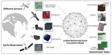
Geospatial Multimodal Foundation Model Overview
A total of 119 projects have direct public dependencies on torchgeo (GitHub tracks this). Some notable ones:
- Natural Resources Canada LINK (Canadian govt. project)
- National statistical institute of Norway LINK
- IBM – projects including SAR2NDVI, RSIR, terratorch
- David Rolnick’s lab — forest monitoring LINK
- Lebanese National Center for Remote Sensing LINK CNRS
- CyberGIS center LINK
- University of St. Gallen LINK
There are also indirect / not-public dependencies, e.g. CalOES used torchgeo.
At least three university classes (Hannah, Esther, Adam) now use torchgeo in homework assignments to teach GeoML, reproducibility, and python.
Other usage stats:
255,688 total downloads on pypi (pip install …), 9,854 last month
21,192 total downloads through conda
72 code contributors
There are 200 people on the public Slack channel
972 unique users visited the GitHub repo past two weeks
** https://github.com/microsoft/torchgeo/releases/tag/v0.6.0


